Connectivity Toolbox
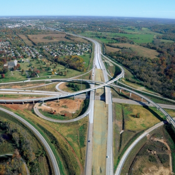
What is Connectivity?
From the Kentucky Transportation Cabinet:
"The term 'street connectivity' suggests a system of streets with multiple routes and connections serving the same origins and destinations. Connectivity not only relates to the number of intersections along a segment of street, but how an entire area is connected by the transportation system. A well-designed, highly-connected network helps reduce the volume of traffic and traffic delays on major streets (arterials and major collectors), and ultimately improves livability in communities by providing parallel routes and alternative route choices. By increasing the number of street connections or local street intersections in communities, bicycle and pedestrian travel also is enhanced A well-planned, connected network of collector roadways allows a transit system to operate more efficiently."
From the American Planning Association:
"In general, connectivity requirements have the purposes of creating multiple, alternate routes for automobiles and creating more route options for people on foot and on bicycles. Additional requirements can be added to the ordinances to establish pedestrian routes and passageways between land uses that can link isolated subdivisions to each other and create the shortest, safest routes possible between origins and destinations. Almost all communities that have pursued street connectivity also prohibit or greatly limit gated streets or gated communities."
Implementing Connectivity
Connectivity is implemented through a community's development standards and subdivision regulations. Maximum block lengths, pedestrian passages, and street connections to adjacent developments can all be stipulated through ordinance. Below are examples of regulations taken from cities and counties across America that try to create connected communities. Several policy guides are also available below.
Model Policies and Guidelines
Connectivity Resources
-
Street Connectivity Zoning and Subdivison Model Ordinance, Model Ordinance and Policy Guide, Kentucky Transportation Cabinet
Roadway Connectivity, Policy Guide, Victoria Transport Policy Institute
Model Street Connectivity Standards Ordinance, Model Ordinance and Policy Guide, American Planning Association
Utah Street Connectivity Guide, Policy Guide, Wasatch Front Regional Council, et. al.
Zoning Module 4 - Connectivity Standards, Policy Guide, Idaho Smart Growth
-
Section 1100.16(d)&(e) Connectivity and Gated Streets, Existing Ordinance, City of Bentonville, AR (Sections of Interest Highlighted)
9.5 Vehicular Circulation, Existing Ordinance, City of Franklin, TN (Sections of Interest Highlighted)
2.1 Standards for Design, Location and Layout of New Streets, Technical Standards, City of Franklin, TN (Sections of Interest Highlighted)
2.1.4 Circulation Plans, Technical Standards, City of Franklin, TN (Sections of Interest Highlighted)
7.10.3 Standards for Street/On-Site Vehicular Circulation, Existing Ordinance, City of Cary, NC (Sections of Interest Highlighted)
-
Sec. 1100.02(e) Joint and Cross Access, Existing Ordinance , City of Bentonville, AR (Sections of Interest Highlighted)
Section 33-1414: Road Specific Cross Access, Land Development Code, Existing Ordinance, Lee County, FL (Requires lots along certain roads to have access to side streets or cross access)
7.10.3(C) Cross Access, Existing Ordinance, City of Cary, NC, Sections of Interest Highlighted)
Agreement to Create Cross Access Agreement, Generic Agreement, Lucas County, OH
Cross Access/Common Driveway/ Cross Parking Agreement, Generic Agreement, City of Phoenix, AZ
Cross Access Easement, Generic Agreement, Lee County, FL
Cross Access Easement Agreement, Generic Agreement, City of Novi, MI
-
Sec. 6.2.203 Cul-de-Sacs and Temporary Turnarounds, Pedestrian and Bicycle Connections, Existing Ordinance, City of Hays, KS (Sections of Interest Highlighted)
§ 25-4-153(C) Blocks Requiring Pedestrian Paths, Existing Ordinance,City of Austin, TX (Sections of Interest Highlighted)
15.420.020(A)(3) Block Design and Pedestrian Accessways, Existing Ordinance, City of Ellensburg, WA (Sections of Interest Highlighted)
9.6.1 Pedestrian Circulation, Placement and Connections, Existing Ordinance, City of Franklin, TN (Sections of Interest Highlighted)
8.2.6 Subdivision Provisions, Blocks, Existing Ordinance, City of Cary, NC (Sections of Interest Highlighted)
7.10.4 Connectivity, Standards for Pedestrian Facilities,Existing Ordinance, City of Cary, NC (Sections of Interest Highlighted)
Street Connectivity Zoning and Subdivision Model Ordinance, Model Ordinance and Policy Guide, Kentucky Transportation Cabinet