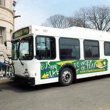
Bicycle and Pedestrian
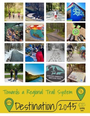
Towards A Regional Trail System
The OTO Board of Directors adopted Towards A Regional Trail System as its new regional trail plan in July 2021. This new plan lays out a vision for 45 by 45, or 45 miles of new trail by 2045. Regardless of where these 45 miles of new trail are built, existing gaps will be filled and communities will be connected. We will have something that can truly be called 'a regional trail system.'
Trail Dashboard
A dashboard has been created to track the region's progress towards achieving its 45 by 45 goal. This dashboard highlights funded projects, recently completed projects, and tracks miles of trail funded since the adoption of Towards a Regional Trail System.
Statement of Priorities for Sidewalks and On-Street Bicycle and Pedestrian Infrastructure
In January 2022, the OTO Board of Directors adopted a Statement of Priorities for local bicycle and pedestrian networks. This includes the development and maintenance of sidewalk and on-street pedestrian infrastructure in the region’s seven cities and two counties. The eight priorities are grouped into three categories. The priorities are listed below.
Structure of Local Bicycle and Pedestrian Networks
- Urban Expressways and Primary & Secondary Arterials should include bicycle and pedestrian infrastructure, such as sidewalks on both sides, multi-use sidepaths, and/or bicycle accommodations consistent with established best practices
- Freeway corridors should include a parallel network of continuous sidewalks, bike lanes, bike boulevards, and/or other industry standard low-stress accommodations along outer roads or other parallel minor streets to facilitate bicycle and pedestrian movement along the freeway corridor
- Local bicycle and pedestrian networks should facilitate safe movement between neighborhoods, local institutions, schools, and commercial areas, and be built according to established best practices
Integration of Local Bicycle and Pedestrian Networks and the Regional Hard Surface Trail Network
- The region’s Hard Surface Trail Network should be integrated into the fabric of each community through numerous neighborhood-level sidewalk and bicycle connection
- Local bicycle and pedestrian networks should be identified and constructed to facilitate movement between trails included in the region’s Hard Surface Trail Network
- Local bicycle and pedestrian networks should be identified and constructed to facilitate movement between local institutions, schools, commercial areas and the region’s Hard Surface Trail Network
Funding
- Local jurisdictions should prioritize the construction and long-term maintenance of their local bicycle and pedestrian network in their annual budgets and capital improvement programs
- Local jurisdictions and MoDOT should negotiate in good faith to find opportunities for cost sharing and beneficial long-term maintenance agreements
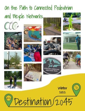
These priorities are embodied in local bicycle and pedestrian networks across the OTO region. On the Path to Connected Pedestrian and Bicycle Networks highlights many of these local examples.
For example, Residents of Strafford can safely move between neighborhoods, schools, and commercial areas. Willard has a pedestrian underpass that connects neighborhoods to the Frisco Highline Trail north of US 160. Ozark has created sidewalk connections between the many commercial areas Jackson St and the new Chadwick Flyer Trail.
Active Transportation
OTO has an active Bicycle and Pedestrian Planning program, with guidance from the OTO Bicycle and Pedestrian Advisory Committee. OTO strives to maintain an inventory of bicycle and pedestrian facilities in the OTO region. This includes an annual review of new sidewalk construction and working with member jurisdictions to catalogue existing bike routes and trails.
Critical Sidewalk Gaps
As part of OTO's Destination 2045 plan, the Bicycle and Pedestrian Advisory Committee worked to identify important gaps in the region’s sidewalk network. These gaps are areas where sidewalks are missing but needed to connect people to essential services like schools, stores, and medical facilities. The committee reviewed the existing sidewalk network in 2024 and used public input through the Destination Safe Streets plan and local unfunded needs to find the most critical gaps. They scored these gaps using factors like safety, population, the type of road, how long the gap is, and how close it is to important destinations. Now that these critical gaps have been identified, OTO is focusing on planning and funding projects to fill them. You can explore the following links for more details about the identified gaps, including summaries by local jurisdictions, how they were scored, and a map showing where they are:
OTO Critical Sidewalk Gap Summary
Check out OTO's Complete Streets Toolbox
Your community can find examples of Complete Streets Ordinances and Resolutions. You can access the latest in bicycle and pedestrian design standards. Create your own Complete Street with StreetMix! Learn how to evaluate the walkability of streets in your community.
Long Range Transportation Plan
Read about OTO's long term vision for active transportation.
Transportation Improvement Program
Read about upcoming bicycle and pedestrian projects.
Give Us Your Input
We want your feedback on bicycle and pedestrian needs throughout the region.
Get Together
Ozarks Commute can help you find a riding, walking, or ridesharing partner.
Bicycle and Pedestrian Reports
These reports cover the wide range of bicycle and pedestrian planning conducting by the OTO.