Route 66 Trail Alignment Study
The Route 66 Trail Alignment Study has begun! Participate in the development of this future trail from the City of Springfield to the City of Strafford. Once the study is complete, drafts of the report will be available on this webpage.

Thursday June 15, 2023 Open House
- The information boards and handouts can be found here:
- Location: 126 Washington St., Strafford, MO
- Time: 4-6 p.m., Thursday June 15, 2023
About the Route 66 in Strafford Corridor Study
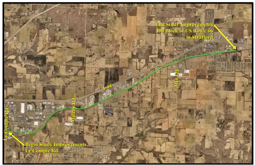
The primary goal of this study is to develop and evaluate alternative trail locations for the Historic Route 66 (Strafford) Trail from Le Compte Rd. in Springfield, MO to Strafford, MO. This trail would be a connection from Strafford to the Springfield Regional Trail System and will ultimately connect to future trail and greenway alignments such as the Division Street Trail and North Jordan Creek Greenway.
The Ozarks Transportation Organization, City of Strafford, and MoDOT are working with Crawford, Murphy, & Tilley (CMT) to determine the safest and most practical location and method for the Route 66 (Strafford) Trail connecting Springfield, MO (at the intersection of Le Compte Rd. and Kearney St.) to Strafford, MO along Historic US Route 66. The purpose of the Route 66 Trail is to provide regionally important bicycle and pedestrian connection between the cities of Springfield and Strafford, Missouri.
The OTO Trail Investment Study completed in October 2017 identified the Route 66 (Strafford) Trail as a priority trail alignment for the region. The project is a key priority for many local and agency partners, with a focus on the following community benefits:
- Reimagine an important piece of Ozarks transportation history by utilizing much of the Historic US Route 66 corridor as a basis for the proposed trail alignment
- Promote regional connection for multi-use transportation by connecting the cities of Springfield and Strafford, Missouri
- Provide a safe transportation corridor for all trail users through congested urban and suburban areas
Have a comment or question about the Route 66 Trail Alignment Study?
If you have a comment or question regarding the Route 66 Trail Alignment Study, follow the link below. Please put "Route 66 Trail Study" as the subject on the comment form.